
Quantification of Orographic Precipitation in Gangneung and Investigation of Topographical Limitations in Gunsan
Abstract
This study aims to quantitatively elucidate the causes of the record-breaking drought in Gangneung in August 2025 using the atmospheric dynamic equation for orographic precipitation, rather than dismissing it as a mere meteorological anomaly. To this end, a comparative analysis was conducted between Gangneung (east of the Taebaek Mountains), which has significant topographical effects, and Gunsan (west of the Taebaek Mountains), which has minimal topographical gradients.
The results show that the drought in Gangneung was not due to a loss of the Taebaek Mountains' topographical function, but rather due to changes in atmospheric circulation. Specifically, westerly winds were dominant during the drought period, suppressing precipitation through the Föhn effect caused by topographical downdrafts. Furthermore, even during intermittent easterly inflows, a lack of moisture supply (mixing ratio, q) prevented the topographical lifting potential from resulting in actual precipitation.
In contrast, Gunsan, the control group with flat terrain (∇h≈0) where topographical lifting (w_{oro}) rarely occurs, experienced extreme heavy rainfall on September 7th due to synoptic forcing. This case demonstrates that precipitation is possible with atmospheric circulation support even without topographical potential, presenting a clear contrast to the drought situation in Gangneung.
In conclusion, this study reveals that the weather patterns of 2025 caused drought in Gangneung and non-orographic heavy rainfall in Gunsan by blocking the key conditions for orographic precipitation: wind direction and moisture. This suggests that macroscopic atmospheric circulation and moisture supply are more critical variables determining precipitation phenomena than local topographical effects.
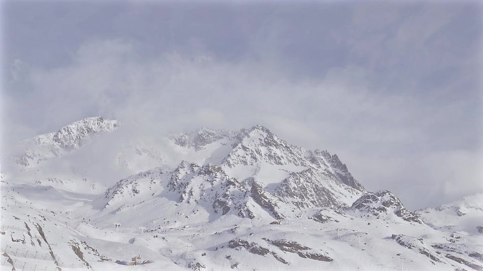
The Windward Effect
in the Taebaek Mountains
Concept
This phenomenon occurs when wind blows toward a mountain range. On the windward side, air is forced to rise due to the terrain, causing it to cool and condense, which leads to cloud formation and concentrated precipitation. Conversely, as the air crosses the mountain and descends on the leeward side, it becomes drier.

Mechanism
(1) Moisture Supply (Advective Transport) Moisture-laden air from sources such as oceans or wetlands is transported toward the mountain face by prevailing winds. The amount of moisture supplied at this stage is a critical factor determining the intensity of precipitation.
(2) Forced Ascent The air is forced upward due to the slope of the terrain. The rate of ascent (vertical velocity) is determined by the product of the cross-barrier wind component and the terrain gradient. As the air rises, atmospheric pressure decreases, causing the air parcel to expand adiabatically and cool down.
(3) Condensation & Precipitation When the air cools below its dew point, water vapor reaches saturation. Once the air rises above the Lifting Condensation Level (LCL), excess vapor condenses to form water droplets (clouds), resulting in precipitation. Consequently, precipitation is maximized on the windward side of the mountain.
(4) Overflow and Descent After crossing the mountain ridge, the air—having already lost much of its moisture—descends and undergoes dry adiabatic heating. As a result, the leeward side becomes dry and warm. This descent creates a rain shadow effect and can generate strong, warm downslope winds known as Föhn winds due to compression.
Orographic Vertical Velocity Equation &
Precipitation–Vertical Velocity Relation

This equation calculates the vertical velocity (w) generated when horizontal wind encounters topographical barriers, such as mountain ranges, and is forced to ascend along the slope.
The Orographic Vertical Velocity Equation
The Precipitation Equation

This formula explains the physical process by which terrain-induced updrafts interact with atmospheric moisture to produce actual surface precipitation (P).
Quantification of Orographic Precipitation in Gangneung Induced by the Taebaek Mountains
Overview | This study selects representative days from the drought period in Gangneung (April 2025 – September 23, 2025). Through a six-step process, variables such as wind speed, wind direction, local pressure, dew point temperature, vertical velocity, vapor pressure, and mixing ratio are determined for these days. These values are then substituted into two equations to calculate precipitation. Finally, by comparing the calculated precipitation values with actual observed data, the causes of the 2025 Gangneung drought are analyzed from a topographical perspective.
Step 1: Selection of Analysis Dates in August
-
Case A: Days with Westerly winds and no rainfall. - > August 19th, August 29th
-
Case B: Days with Easterly winds but no rainfall. -> August 24th, August 22nd
Step 2: Terrain Gradient Data of the Taebaek Mountains (∇h)
The terrain gradient is calculated using data from Daegwallyeong (approx. 37°N), which is part of the Taebaek Mountains and located at a similar latitude to Gangneung.
-
Elevation of Daegwallyeong: 832m (Measured as the straight-line distance from the Gangneung coast to the peak of Daegwallyeong via Google Earth).
-
Elevation Difference : 832m - 0m = 832m
-
Horizontal Distance from Coast to Peak : 24.6km = 24,600m
-
Terrain Gradient (∇h) : 832 / 24600 = 0.0338
-
Calculation Result: ∇h = -0.0338$
Step 3: Wind Speed and Direction Data
While wind data from the 850hPa isobaric surface is most suitable, Automated Synoptic Observing System (ASOS) data was used as a substitute due to the unavailability of the former on the Korea Meteorological Administration portal.
Step 4: Mixing Ratio (q)
The mixing ratio is calculated by substituting the moist air pressure and vapor pressure into the mixing ratio equation.
Step 5: Precipitation Efficiency
-
Definition: Precipitation Efficiency is a ratio that adjusts theoretical values to reflect reality by accounting for losses, such as water vapor remaining as cloud droplets without falling or evaporating upon encountering dry air while falling.
-
Experiment for Setting Efficiency: To calibrate the efficiency, precipitation was calculated using 2024 observed data (wind speed, direction, local pressure, dew point) with ε initially set to 1. These results were then compared with actual observed precipitation data.
-
Conclusion: Theoretical formulas calculate the "maximum possible value" assuming all water vapor converts to rain, leading to overestimation. Back-calculation using August 2024 data showed that orographic clouds produced actual rain at only about 15% to 20% of the theoretical value. Therefore, applying ε = 0.15 provides a realistic estimate of potential precipitation for the 2025 drought analysis, enhancing the persuasiveness of the study.
Step 6: Precipitation Calculation using Google Sheets
= IF(M2 > 0, 0.15 * 1.225 *M2 * (O2 / 1000) * 3600, 0)
-
IF(M2 > 0, ...): Assumes precipitation occurs only when wind ascends the mountain slope (w > 0).
-
0.15: Precipitation Efficiency. A reality correction factor derived from the 2024 analysis.
-
1.225: Air Density in kg/m^3. The sea-level standard value from the International Standard Atmosphere (ISA).
-
M2: Vertical Velocity (w) in m/s.
-
O2 / 1000: Mixing Ratio (q). Divided by 1000 to convert the unit from g/kg to kg/kg.
-
3600: Converts velocity from seconds (m/s) to hours (m/h) to calculate hourly precipitation (mm/h).


Analysis of results
Case A: Days with Westerly Winds (Aug 19, 29) → "The Terrain Blocked the Rain"
Phenomenon:
Both calculated precipitation (P_{calc}) and observed precipitation (P_{obs}) closely corresponded, showing near-zero values.
Interpretation:
As westerly winds crossed the Taebaek Mountains, orographic downslope winds were generated. This induced the Föhn effect, characterized by adiabatic compression and warming, which fundamentally inhibited cloud formation.
Conclusion:
During this period, the topographical factor (Taebaek Mountains) exacerbated the drought by acting as an 'umbrella' that actively suppressed precipitation.
Case B: Days with Easterly Winds (Aug 22, 24) → "The Orographic Effect Alone Was Insufficient"
Phenomenon:
While calculations indicated a theoretical potential for approximately 18.5mm of rainfall (2-day total), zero precipitation (0mm) was actually observed.
Interpretation:
The mechanism for orographic forced ascent (w > 0) was clearly active due to the easterly winds. The lack of precipitation, despite this lift, suggests the presence of a strong synoptic-scale high-pressure system aloft (subsidence) that neutralized the orographic effect, or that the incoming moisture layer was too shallow to support vertical cloud development.
Conclusion:
"This demonstrates that the 2025 drought was not caused by the absence of orographic lifting, but rather by changes in atmospheric circulation that suppressed the 'activation' of the orographic precipitation mechanism."

Limitations of the Orographic Effect of the Taebaek Mountains and Analysis of Extreme Rainfall in Gunsan
Overview | This study confirms that Gunsan's extreme rainfall occurred despite negligible orographic lift (w≈0) due to its flat terrain, driven by synoptic-scale factors such as a Low-Level Jet and dynamic convergence rather than the distant Taebaek Mountains. This highlights that precipitation in Gunsan is determined by non-orographic mechanisms like thermodynamic instability and oceanic moisture inflow, necessitating a distinct meteorological approach from Gangneung.
Geographical Location and Topographical Characteristics (∇h≈0) and Contradiction
-
Flat Terrain Structure: Gunsan is part of the Honam Plain adjacent to the west coast. While small hills such as Mt. Oseong (227m) and Mt. Wolmyeong (101m) exist, massive mountainous terrain comparable to the Taebaek Mountains is absent.
-
Characteristics of Terrain Gradient : Unlike Gangneung, where altitude rises rapidly from the coast to the inland, Gunsan exhibits a very gentle slope toward the inland. Therefore, when applying the atmospheric dynamic equation for orographic vertical velocity, the terrain gradient term ∇h converges to 0.
-
Discrepancy between Calculation and Reality: Theoretically, the forced ascent due to topography (w_{oro}) is nearly zero. Nevertheless, the fact that record-breaking heavy rainfall occurred on September 7, 2025, suggests that this precipitation was driven by powerful external factors rather than topographical factors.
Geographic Isolation from the Taebaek Mountains and Exclusion of the 'Rain Shadow' Effect
-
Distance Limitation: Gunsan is located more than 200 km west of the Taebaek Mountains.
-
Dilution of the Föhn Effect: Even if easterly winds crossing the Taebaek Mountains become hot and dry (Föhn effect) and move westward, the air undergoes atmospheric mixing while passing over the Sobaek and Noryeong Mountains and traveling a long distance.
-
Analysis Result: While the drought in Gangneung can be discussed in terms of "suppression by topographical factors," the heavy rainfall in Gunsan originated from an independent meteorological system unrelated to the Taebaek Mountains. In other words, precipitation in Gunsan must be interpreted as being outside the range of influence of the Taebaek Mountains' topography.
Expected Precipitation Mechanism in Gunsan
Precipitation in the Gunsan region, where topographical factors are excluded, is determined by the following non-orographic factors:
-
Oceanic Moisture Inflow: Being adjacent to the Yellow Sea allows for direct moisture supply from the ocean, serving as the core source of precipitation. (Summer rainfall accounts for approx. 55% of the annual 1,246 mm).
-
Dynamic Convergence: Instead of forced ascent by terrain, horizontal convergence of air occurring in cyclonic circulation or frontal zones induces upward motion (w) to the upper layers.
Sub-conclusion: Investigation of Causes of Extreme Rainfall in Gunsan in 2025
The analysis using the atmospheric dynamics equation in this study confirmed that Gunsan is a region where orographic lifting (w_{oro}) barely occurs . It is also outside the direct influence of orographic downdrafts due to its geographic distance from the Taebaek Mountains.
Therefore, the extreme heavy rainfall in Gunsan on September 7, 2025, is interpreted as stemming from changes in synoptic-scale atmospheric circulation rather than topographical factors. Specifically, it is judged that a Low-Level Jet flowing along the edge of the North Pacific High and a strong convergence zone generated overwhelming upward motion even without topographical effects.
Conclusion
While it is true that Gunsan is located west of the Taebaek Mountains, the great distance between them makes it difficult for Gunsan to be meteorologically influenced by the mountains in the same way as Gangneung. Therefore, analyzing the precipitation structure of Gunsan requires an approach from different atmospheric dynamic and meteorological perspectives.
Total Conclusion
In this study, the orographic precipitation efficiency of the Taebaek Mountains was validated using data from 2024 (a wet year). Based on this, the causes of the precipitation deficit during the 2025 drought were analyzed from a topographical perspective. The analysis revealed that the drought in Gangneung was not due to the disappearance of the topographical factor of the Taebaek Mountains, but rather because changes in atmospheric circulation blocked the "operation" of the orographic precipitation mechanism.
Dominance of Westerly Winds (Suppression of Orographic Precipitation):
The analysis of cases with westerly winds (Case A) during the drought period in August 2025 showed that the calculated vertical velocity (w) in the equation was negative (-). This quantitatively proves that the Taebaek Mountains, instead of generating rain clouds, induced the Föhn effect—causing air to descend and compress—which further dried the atmosphere in the Gangneung region. In other words, this is a case where topography actively hindered precipitation.
Inflow of Easterly Winds (Failure to Realize Potential):
Even in cases where intermittent easterly winds occurred (Case B) and generated orographic lifting (w > 0), the actual observed precipitation was 0 mm. Although calculations indicated a precipitation potential of approximately 18.5 mm or more, the lack of rainfall was attributed to a deficiency in moisture supply (mixing ratio, q) and the stagnation of an upper-level high-pressure system. This suggests that while the "trigger" (Taebaek Mountains) existed, the "material" (water vapor) required to produce rain was insufficient, or large-scale atmospheric circulation suppressed the process.
In conclusion, the extreme drought in Gangneung in 2025 was the result of a combination of "orographic precipitation suppression (Föhn effect)" caused by frequent westerly inflows and the "failure to realize orographic potential" due to moisture deficits even when easterly winds were present.